Latest First.. I like all waterways and have an interest in Geography so some jottings
2019 the Danube:
Having tracked the Rhine from one of its two major tributaries (hinterrhein) to Schaffhausen and Rheinfall. We headed north to Hufingen. This lies on the river Breg which rises northeast of Freiburg and is the primary tributary of the Danube from here
The Breg then flows southeast to Hufingen then north to Donaushingen where it become the Donau (Danube) travelling generally in an easterly direction via Ulm and Regensberg to Vienna and continues through Hungary then the Balkans and finally Romania to the Black Sea. We followed parts of the Danube in 2014 to Romania (via Vienna and Budapest). We will only visit it briefly in 2019(Hufingen to Donauschingen).
2019 The Rhone, the Rhine, the Ticino and associated passes.
After the Danube the two longest rivers in Europe are the Rhone and the Rhine
(some say The Volga is the longest but it is in Russia !)
We entered Switzerland near the source of the Doubs which is in France more on French rivers later..
We travelled past Berne and then followed the Aare upstream to Interlaken and then turned South to Col des Mosses and the Upper Rhone Valley so Col des Mosses part of a watershed with water on the south flowing to the Rhone and waters in the North flowing to the Aare. The Rhone has a big change of direction near Martigny where it turns from west to north and flows to Lake Geneva next heading south then northwest and west to Lyon then finally south to the Mediterranean. My focus is the upper Rhone which has its source as the Rhone glacier near Obergoms, which can be accessed by travelling east on the "upper Furka".
So Obergoms is of interest because if you go north over the Grimsal pass you cross the watershed as north of the pass waters join the Aare. The largest river entirely within Switzerland which makes is way in a clockwise circular fashion via Interlaken and Berne to join the Rhine at Koblenz (In Switzerland) and indeed its flow is greater than that on the Rhine. The Aare drainage ares covers most of Central Switzerland.
So the Grimsel pass is a significant watershed. After descending the Grimsel we turned east to Lake Lucerne and the south towards Andermatt and the eastern base of the Furka pass. So waters on the west of the Furka summit drain to the Rhone, waters on the east drain via the Reuss Lake Lucerne and then the Aare and so to the Rhine
Andermatt is north of the St Gotthard pass so waters in the Andermatt area will drain to Lake Lucerne etc.
We drove over the St Gotthard to the Italian speaking region of Ticino named after its major river which descends via Lake Maggiore to join the Po at Pavia south of Milan.
The Po being the major river of Northern Italy which drains the Italian side on the Alps, flowing east to the Adriatic south of Venice..
Back to Southern Switzerland..From the Ticino we headed north over the San Bernadino pass and into the Hinterrhein a watershed which feeds the Upper Rhine. This is one of the two major tributaries the other being the Vorderrhein which drains the eastern side of the Oberalp pass which is just north and east of Andermatt. The two tributaries meet at Reichenau where the name is simply Rhein and it then flows main north to the Bodensee then in a general westerly direction to Basel, via Schaffhausen and the Reinfalls. After Basel the Rhine turns northwards through Germany and to Rotterdam.
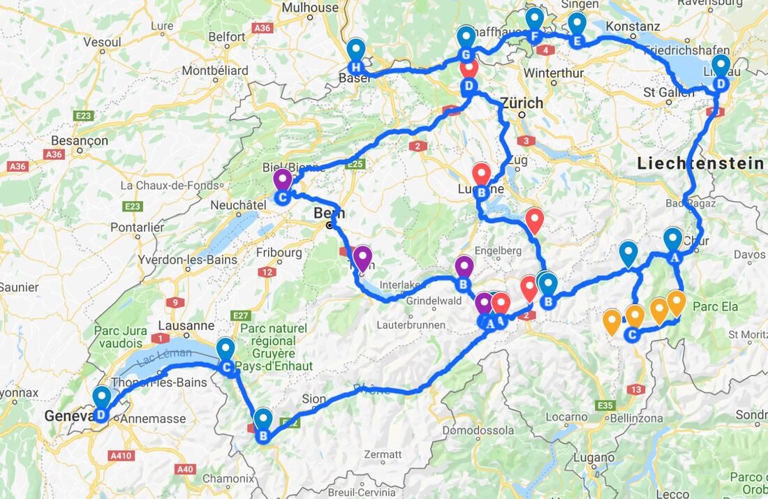
The image above focuses on our trip and the Rhine and Aare. to the west of Obergoms the course of the Rhone is easy to see.
It is interesting to note the almost complete circuit Bellinzona to Hinterrhein to Reichenau and then to Andermatt.
Another interesting circuit is Obergoms to Interlaken Berne and to Zurich then north and east via the Bodensee and then south to Reichenau and west to Andermatt with the missing link being the Furka pass.
Thus the Rhine/Aare catchment area drains most of central Switzerland.
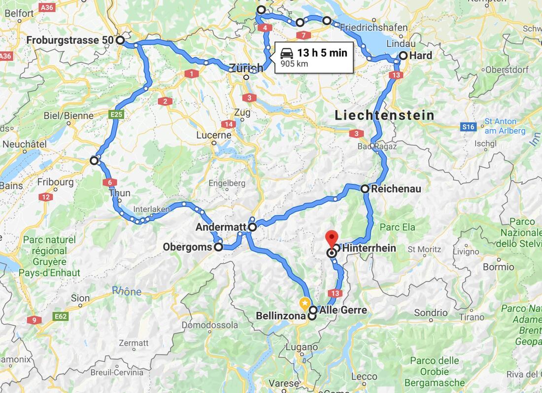
The map below maybe more helpful with colour coding or you can link to here.
It is interesting to note the almost complete circuit Bellinzona to Hinterrhein to Reichenau and then to Andermatt.
Another interesting circuit is Obergoms to Interlaken Berne and to Zurich then north and east via the Bodensee and then south to Reichenau and west to Andermatt with the missing link being the Furka pass.
Thus the Rhine/Aare catchment area drains most of central Switzerland.
The map below maybe more helpful with colour coding or you can link to here.